The AEMA database comprises records of several distinct types of Find. The Search page allows the user to filter the records in the database by combining different criteria. The records which meet the criteria are displayed on map and are also listed in summary form in a table on the right hand side of the webpage. The search results can then be interrogated in more detail by clicking on the map markers to show information in popups, and can also be exported to a data file format known as GeoJSON, which can be opened in QGIS.
For attribution, see the bottom of this page
The simplest way to search through the datasets is to use checkboxes that are nested beneath the data type headings, which will be revealed when the user clicks on the arrows next to the headings, as below.
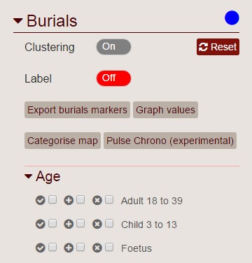
The checkboxes allow the user to express nuanced queries to the database by specifiying whether a particular facet should be present or absent from the refined selection. Addtionally, the user is able to specify whether a particular facet must be present in all selected records (an AND type query) or whether the selection returned will include records where any of the criteria are satisfied (an OR type query).
The examples below help to explain this concept.
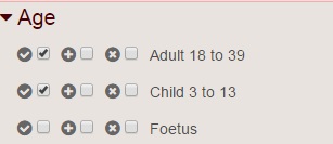
This selection is querying for Burial records where an Adult AND a Child are present, i.e. the search is refined by the addtion of new criteria.
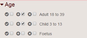
This selection is querying for Burial records where an Adult OR a Child are present, i.e. the search is cumulative with the addtion of new criteria.
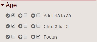
Finally, this selection is querying fro Burial records where and Adult AND a Child are present and there is NO Foetal individual present.
All the main data types can be searched in a similar way and the resulting records will all be displayed on the same map so that the distribution of data can be clearly seen in relation to one another.
These data sets are derived from the same source Burial data, but allow the user to access the data at different levels. The Burials data is a top level summary of all Individuals, Pots and Gravegoods associated with a site.
The Individuals allows the sites to be refined by the particular features of an Individual found at the site. This is an important distinction. For instance, if a user were to search for Burials where individuals were oriented East-West and where a Beaker style pot is found, this will show all Burial sites where this orientation is observed and this type of Pot is found. However, if a user were to use the same criteria when searching the Individuals section, the results will only show Individuals who have a Pot of this type associated with the Individual directly. i.e. with a Burial selection, the combination of criteria is applying to ALL Individuals at the site regardless of whether or not the two example criteria are applicable to a particular Individual.
The Pot and Gravegoods is more specific again, allowing for a search across multiple criteria that apply to the same Pot or Gravegood, rather than Individuals associated with multiple Pots or Gravegoods that collectively exhibit the criteria.
These data sets are entirely distinct form each other and posess their own searchable facets which can be queried as described above.
There are some data fields across all data types that are indexed for "free text search", which can be helpful when looking for a particular record or when a set of criteria cannot be easily expressed with the checkbox type search.
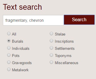
By default, all the available data types will be searched when a Text Search is performed, though a user is able to refine these results by selecting just one of the data types using the radio buttons below the Text Search field, as below.
The map background layer can be changed by using the layer switcher in the top right hand corner of the map. By default, the map background is topographical, bare earth representation created with reference to Barrington Atlas of the Greek and Roman World and has been created by the Ancient World Mapping Centre.
Also available is a Modern layer provided Thunderforest and derived from Open Street Map data and a Plain "coastline only" map.
Also available through the map layers button in the top right of the map window is the to option show and hide the different data type layers created through the user search.
Although currently a work in progress, effort is being made to make data sets from the Atlas for Celtic Studies (Oxbow 2007) available. A selection of these layers is currently available by clicking on the map layers button, and then selecting the option for More Layers... at the bottom of the menu.
Also within the database is a large set of records relating to the chemical composition of metal finds across Europe. This data is available by clicking on the layer switcher button on the top right corner of the map and then selecting More Layers.
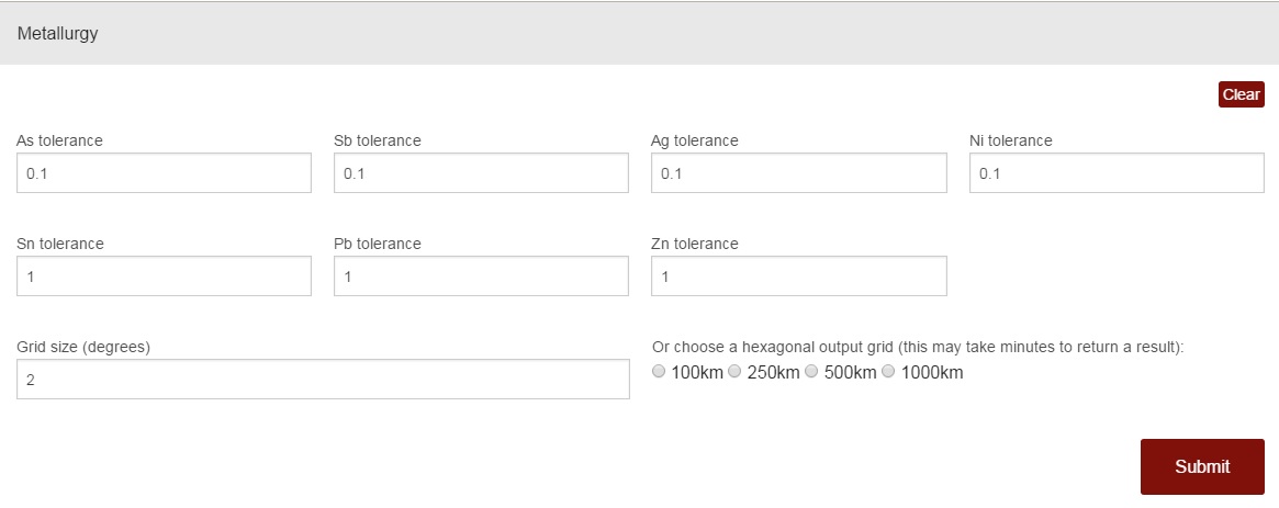
The topmost option, Metallurgy, in the popup window allows the user to specify tolerances for the presence of various metallic elements as percentages of the composition in order to characterise finds into copper "families". There are default values in place and the results are not displayed on the map as points but as coloure regions indicated by the dominance of particular metal compositions. Users are able to output the results to regions defined by a rectangular grid or by a hexagonal grid.
The resulting grids can be clicked on to reveal more information about the number of finds in a region and the summary composition of those finds.
NB. This feature may talk up to a minute to return a map to the browser as the user defined criteria are being applied in real time to around 30,000 individual metallurgy records.
The categorisations have been defined in the work of Peter Bray.
By default, when a selection of records is displayed on the map, the individual points will be clustered together, if they are likely to overlap. Clicking on one of these clusters will zoom the map to that area and the points on the map will automatically recluster to adjust for the simplest display. This clustering behaviour can be disabled on all data layers by deselecting clustering from the options beneath the data type headings as shown below.
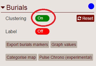
The other options availble in this section of the web page allow a user to clear the search for that data type (reset), to display a label for the map points (label), to theme the map (categorise map) and to display simple graphs of the values found in the data set.
The Categorise Map option will present the user with all the available criteria by which the map points can be coloured. NB. If a map point cannot be characterised by a unique value in the selected category, it will be hidden from the map display until the points are uncategorised.
The Graph Values option also presents the user with the available criteria (given the search results) that can be used to create a histogram or a pie chart of the distribution of values within the data set.
Please observe the follow requirements for correct attribution:
Data extracted using 'Burials', 'Individuals', 'Pots', 'Gravegoods', 'Metalwork' and/or 'Miscellaneous' should be credited to Gibson, C. & Cleary, K.
Data extracted using 'Stelae' should be credited to Gibson, C.
Data extracted using 'Inscriptions' and/or 'Toponyms' should be credited to Fernández Palacios, F. & Koch, J.T.
Data extracted using 'Settlements' should be credited to Cleary, K, Gibson, C., Hawkes, A. & Karl, R.
Data extracted using 'Metallurgy' under 'Additional data layers' should be credited to Bray, P.
Data extracted using all other categories under 'Additional data layers' should be credited to Koch, J.T.
Database implementation and maintenance should be accredited to Jakeman, N.